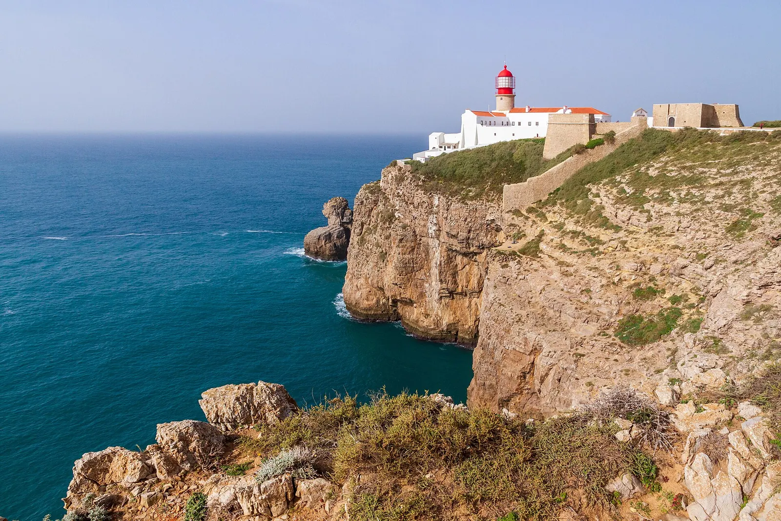
The Cabo de São Vicente lighthouse on cliffs above the Atlantic, Algarve
Wave 2🇵🇹 Portugal · Road cycling destination

Algarve

Portugal's southern edge: an Atlantic cape at the corner of Europe, cork-oak hills inland and one of the mildest winters on the continent.

Photo: Matthias Süßen · CC BY-SA 4.0

Prime months
Feb–Jun, Sep–Dec
Signature climb
Fóia (902 m)
Fly to
Faro (FAO)
Terrain
Rolling hills · Coastal · Mountains
Status
Wave 2 guide · sourced facts 14 Nov 2026; local details in research
01
The feeling

Winter sun at the corner of Europe

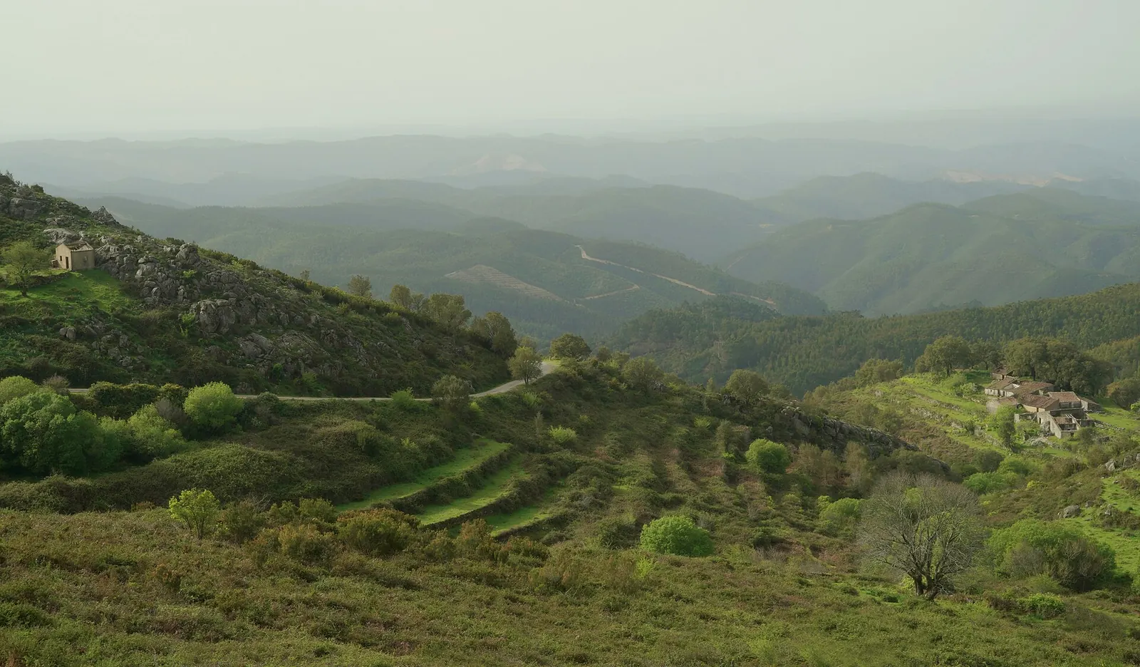
The Algarve is Portugal's southernmost region. Most visitors stay on the beaches; for a road cyclist the interest lies behind them. In the west the Serra de Monchique rises to Fóia (902 m), the highest mountain of the Algarve, reached by a long, steady road from the spa village of Caldas de Monchique. Further east, the cork-oak hills of the Serra do Caldeirão roll away from the coast.

At the western tip, Cape St. Vincent is the south-westernmost point of Portugal and of mainland Europe – a natural end point for a ride along the Atlantic.

The climate is the main reason to come: at Faro, average highs stay around 16–19 °C from December to March (see the table below). Detailed day routes are in our ready-made itinerary pack; this free guide covers the essentials.

Forested hills of the Serra de Monchique, Algarve
The Serra de Monchique · Photo: Serge Fenenko · CC BY-SA 4.0
02
The ride

Roads, climbs & who it suits

Is it for you?

Rider fit & trade-offs

Editorial Provisional – to verify Our judgement, based on the sources below. Disagree? Ask or suggest a correction.

Suits

  • Winter and early-spring riders
  • Couples and groups
  • Riders who want a ready-made plan
Rider level
Beginner / recreational → Experienced climber
Climbing
Moderate climbing
Traffic
Mixed
Road surface
Good
Cycling services
Medium
Ideal stay
3–7 days
Cost level
€€ (estimate)

Strengths

  • Very mild winter and spring (see climate)
  • Premium 3-, 5- and 7-day itinerary pack available
  • Coast + hills in one trip

Compromises

  • Busy coastal main roads – the hills are quieter (to verify)
  • Hot in July and August
  • Climbs are moderate – Fóia tops out at 902 m
Roads & traffic

On the road

  • Coast vs. hills: the coastal strip is the busy part of the region; the interior hills are where the quieter roads are. Named quiet roads and traffic hot spots – to verify on the ground
  • Surface: road-surface notes – to verify
  • Services: bike shops, rental and repair – named and dated once checked
Terrain & elevation

The lay of the land

Three bands: the Atlantic coast and cliffs in the west, the lowland coastal strip along the south, and the hills behind it – the Serra de Monchique in the west (Fóia, 902 m) and the Serra do Caldeirão further east.

Climbs are moderate by alpine standards: the Fóia road averages under 5 %. Expect rolling days with one or two longer ascents rather than big mountain stages.

Signature climbs & routes

The ones you came for

Published figures vary slightly with start and finish points; we show one sourced version for each. GPX: [PLACEHOLDER] GPX collection – Release 2

Signature climb

Fóia from Caldas de Monchique

16.4km
795m gain
4.9avg %

The long climb to the highest point of the Algarve. The start, Caldas de Monchique, is a spa village with hot springs about 6 km south of Monchique.

Figures: Climbfinder; summit and Caldas: Wikipedia
Ready-made

Day routes in the itinerary pack

Nine day routes and 3-, 5- and 7-day plans are in the premium Algarve pack (see Experiences below). The free guide does not repeat them.

03
The stay

Where to base yourself

Base towns

Recommended base towns

Editorial Base-town choice is our editorial judgement.

  • MonchiqueHill town at the foot of Fóia – the base for the Serra de Monchique.
  • FaroAirport city; the airport is about 4 km west of the centre.
  • Western Algarve / SagresFor the Atlantic coast and Cape St. Vincent. Specific base town – to research

Cycling-friendly hotels

[PLACEHOLDER] Boutique and cyclist-friendly hotels: bike room, workshop corner, early breakfast

Villas & groups

[PLACEHOLDER] Villas and group accommodation with secure bike storage

Pools & recovery

[PLACEHOLDER] Swimming pools, spas and recovery options near the base towns

04
The taste

Coffee, cake & long lunches

Every ride needs a stop. We only list places we have checked – this chapter is being researched for Algarve.

  • [PLACEHOLDER] Coffee stops and cyclist-friendly cafés
  • [PLACEHOLDER] Bakeries for the second breakfast
  • [PLACEHOLDER] Restaurants worth the ride
  • [PLACEHOLDER] Regional specialities
  • [PLACEHOLDER] Recommended mid-ride stops
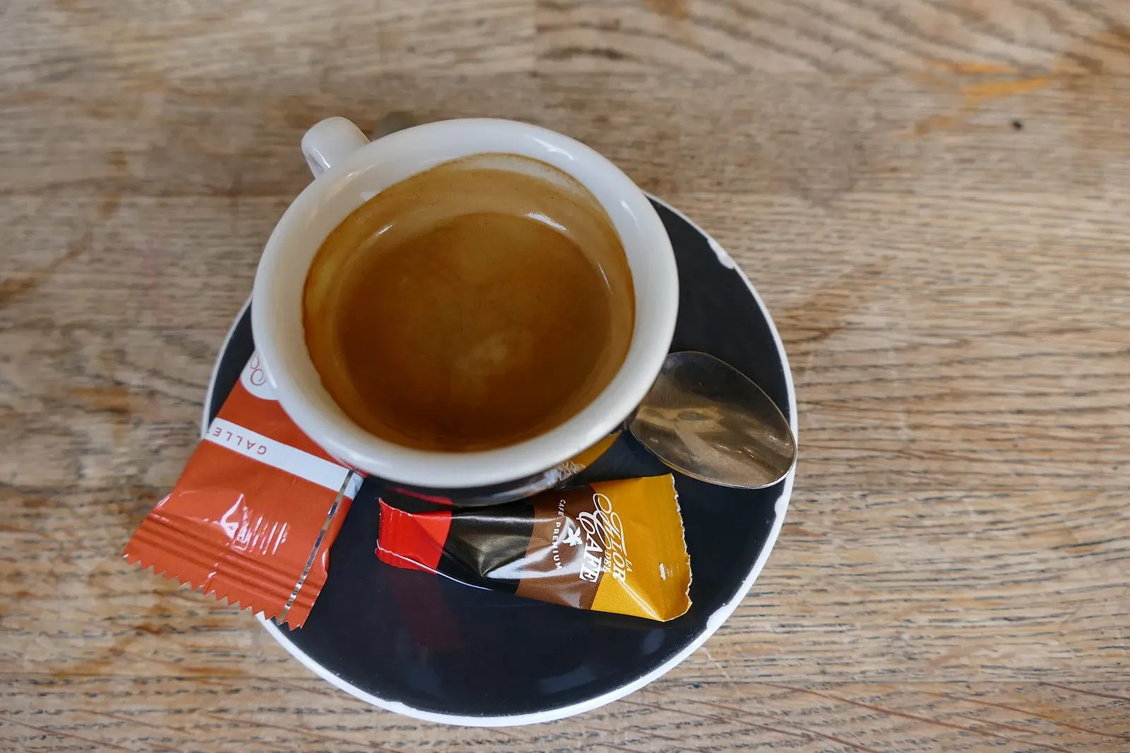
An espresso on a saucer on a wooden café table
Illustrative photo – not taken in Algarve · Photo: Kritzolina · CC BY-SA 4.0
05
The feeling & surroundings

Landscape, climate & rest days

When to ride Algarve

October to May is the riding season on the coast – mild, with most of the year's rain between October and January. June to September is hot and almost dry; ride early. The hills are cooler than Faro.

Average daily high (°C). Outlined bars = “prime” riding months under our published rule.

Climate averages for Algarve
Faro Airport (IPMA)JanFebMarAprMayJunJulAugSepOctNovDec
Avg high °C16.317.018.920.723.526.829.429.226.423.319.617.1
Avg low °C8.38.810.812.415.017.819.619.918.315.811.99.7
Rain mm494247392651322567690
Rain days6.05.45.65.33.80.80.20.21.96.06.67.0
Sun hours182172243254305327361345279227192159
RatingGoodPrimePrimePrimePrimePrimeGoodGoodPrimePrimePrimePrime

Station: Faro Airport (IPMA), 1991–2020 normals. Faro is on the coast; the Serra de Monchique and Serra do Caldeirão are cooler. Rain days = days with ≥ 1 mm. Sunshine 1971–1995. Source: Wikipedia – Faro, climate table (source: IPMA), retrieved 14 Nov 2026. Rating rule: how we rate months.

Landscape & nature

Atlantic cape, cork-oak hills and a mild winter – with a ready-made itinerary pack. Editorial

Local culture

[PLACEHOLDER] Villages, festivals and traditions worth knowing

Rest-day ideas

[PLACEHOLDER] Walks, swims, wineries, museums – to be researched

06
The practicalities

Getting there & getting sorted

Getting there

From Switzerland

Fly: Faro International Airport (FAO) is the region's airport, about 4 km west of Faro. Current direct flights from Zurich, Basel and Geneva – to verify for your season

Bike: bring your own (book sports equipment with the airline) or rent locally. Named rental options – to verify

Practical information

Good to know

  • Portugal is one hour behind Switzerland (WET/WEST).
  • Currency: euro.
  • In summer start early – the station averages highs near 29 °C in July and August.
  • Pack a layer for the Fóia descent, even in spring.

Bike rental, transfers & mechanics

Independent recommendations only. If we ever earn a commission, the link will be labelled – and it never decides what we recommend.

Bike rental & repair

Availability: Medium Editorial Provisional – to verify

[PLACEHOLDER] Named rental shops and workshops, with date last verified

Bike shops & mechanics

[PLACEHOLDER] Local bike shops and mechanics, with date last verified

Transfers, car rental & bike transport

[PLACEHOLDER] Airport transfers for bike boxes, taxis, luggage transfer, public transport

Estimated cost level: €€ Editorial Provisional – to verify – a relative editorial estimate, not a price.

Estimate your trip budget
07
Recommended experiences

Make the most of it

Best rides

  • Day routes in the itinerary pack

Must-do climbs

Open the Climbing Atlas →

Events

  • [PLACEHOLDER] Gran fondos, sportives and group rides – dates to verify each year

Nearby & worth packing

Premium itinerary pack
The Cabo de São Vicente lighthouse on cliffs above the Atlantic, AlgarveNew
Itinerary pack · Portugal

Algarve, Portugal – Road Cycling Itinerary Pack

3 itineraries · 3, 5 and 7 days · 15 riding days in total

Skip the hours of route research. Land in Faro, open the guide and ride: tested road choices, the climbs that matter and where to stop for coffee – planned day by day.

  • 3-, 5- and 7-day itineraries, day by day
  • 9 road routes with distance & climbing
  • Simple directions on real roads
  • Climb guide with sourced gradients
  • Base towns & best months
  • Coffee stops we checked
  • GPX files (coming soon)
€19one-off payment · all three itineraries · Online guide – unlocks instantly in your browser
What's inside
Gallery

Get in the mood

Data quality

Sources & last verified

  • Data Climate: Faro Airport (IPMA), 1991–2020 normals – retrieved 14 Nov 2026
  • Editorial Rider fit, terrain, traffic, cost level, base towns – provisional editorial judgement from desk research, 14 Nov 2026
  • Seasonal: pass opening, rental stock and flight schedules change by season – check before booking.
  • Not live data: nothing here is a forecast, live road report or confirmed price.

Still to verify

  • Rental availability for your dates
  • Direct flights from Switzerland to Faro this season
  • Traffic on the N125 coast road

Report outdated or wrong information →

Ask a question

Unsure about Algarve?

Ask about routes, the best month, rentals, accommodation or logistics. Good questions may become a public FAQ – only with your consent.

Prototype Prototype: this form sends nothing. Submissions are only previewed in your browser.